| Location | |
|---|---|
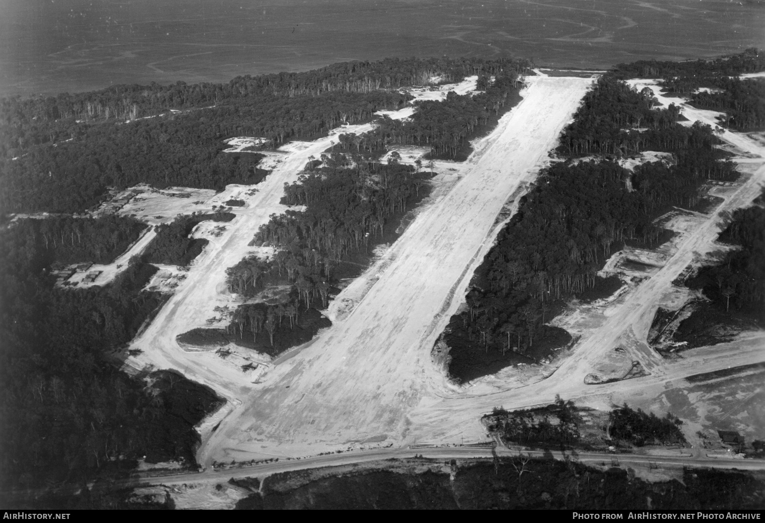
| City / Airport: | Emirau IslandMap |
| Country: | Papua New Guinea |
| Airport Codes: | ICAO: AYEE IATA: EMI Local: - Other: - |
| Date & Photographer | |
|---|---|
| Photo Date: | 1945 |
| Photo from: | AirHistory.net Photo Archive |
| Photo ID: | 430200 |
| Photo Comment |
|---|
|
Emirau Island airport was built as two adjoining airstrips - Northern Cape for bombers, which is the one in the photo, and Inshore for fighters. The two were connected by a taxiway. The airfields now are considered to be one airport and in use. Satellite photos show Northern Cape's runway is less neglected than Inshore. Photo from: RNZAF/Air Force Museum of New Zealand This photo was added on 13 January 2022, and has since been viewed 329 times. |