How to find the Coordinates for your photo
This page describes how to find the coordinates of an aircraft that is away from an airport, seaplane base, heliport/pad or museum.
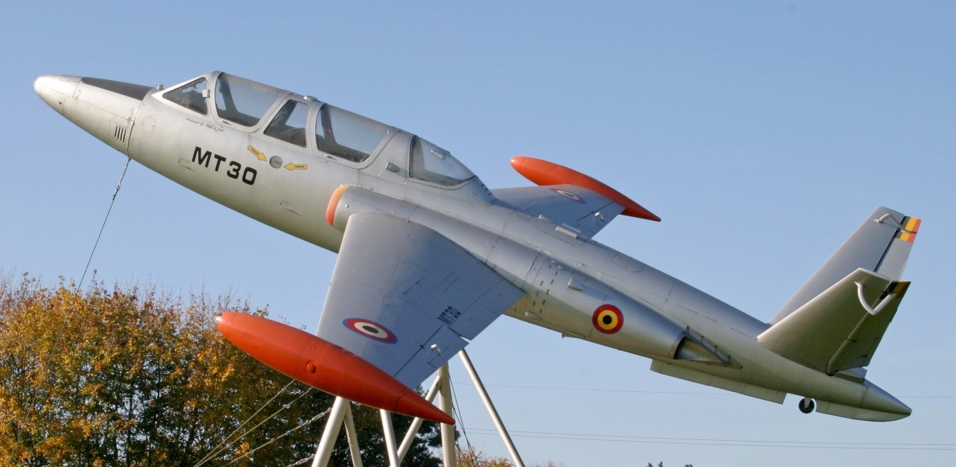
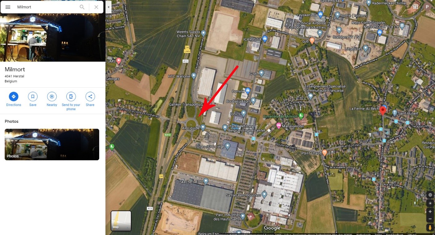
To illustrate the procedure, we have chosen a Fouga Magister displayed at a roundabout in the small village of Milmort in Belgium. It also could be an ambulance helicopter on a street, an aircraft accident site, a balloon operating from a park, an overflying helicopter or an aircraft being moved by road, the reasons why an aircraft will be photographed away from an airport are unlimited.
Step 1. Open Google Maps. On the left you will see a number of windows, ignore them except the “Search Google Maps”.
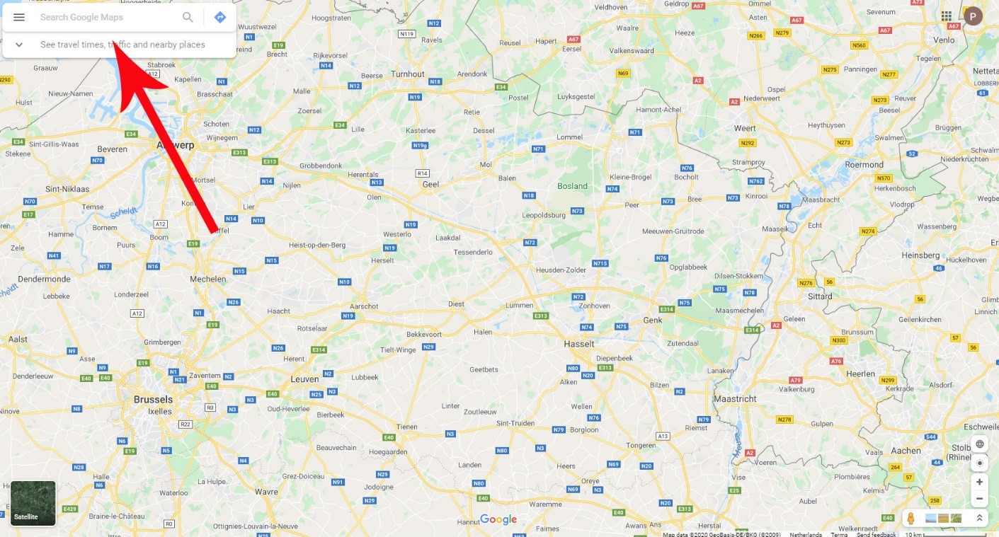
Step 2. Type the name of the town you are looking for in that “Search Google Maps” window (here Milmort) and press enter, or click on the magnifier symbol. You will now arrive at the town.
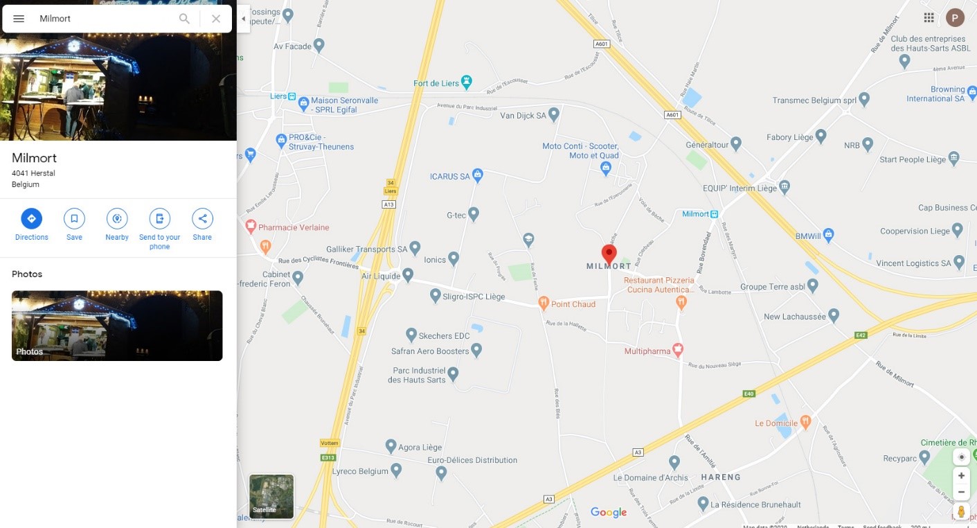
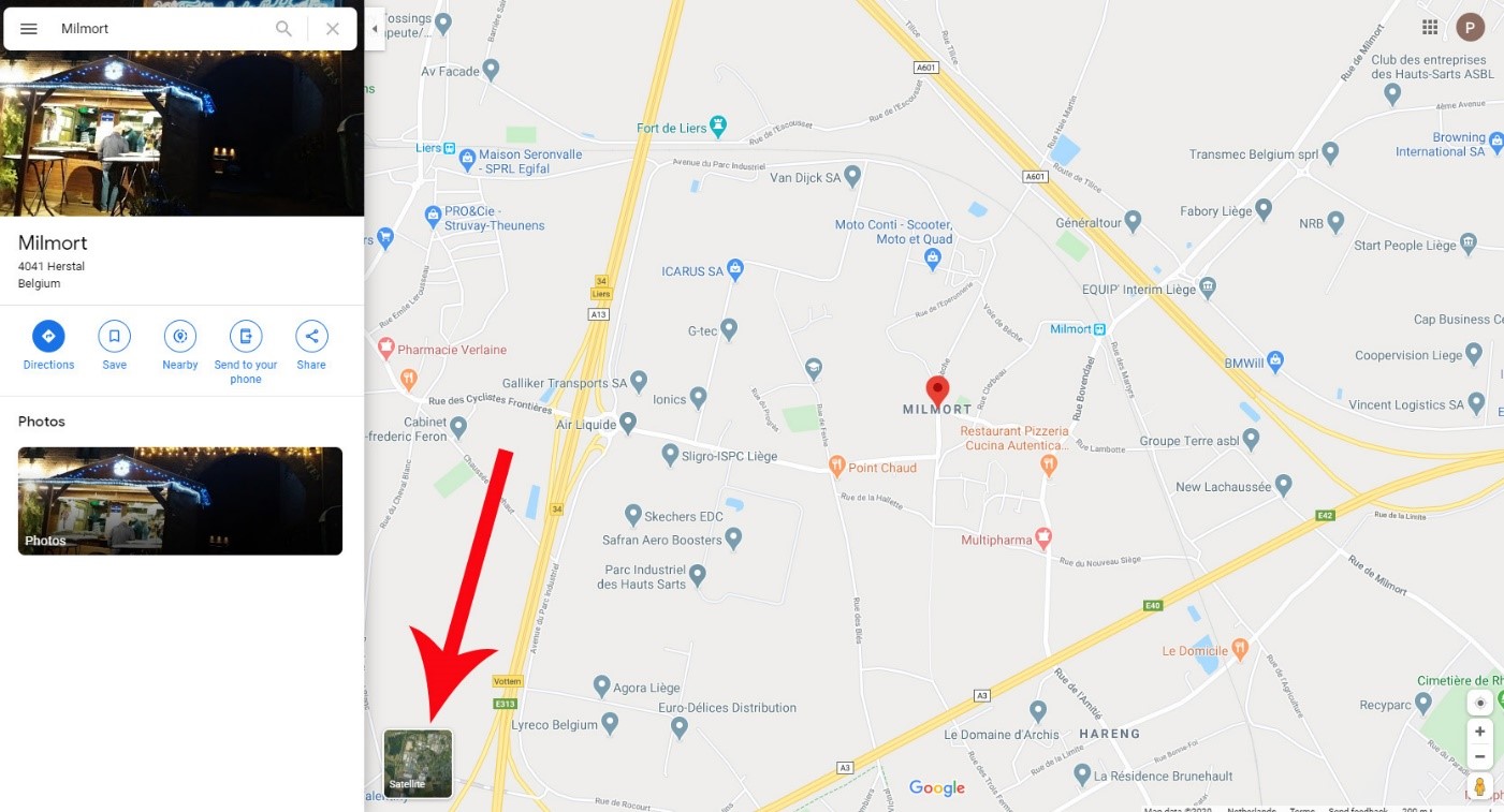
Step 3. Click on the “Satellite” button below left.
Step 4. On the satellite picture that now appears, find the place where your aircraft is situated, here it is at the roundabout.
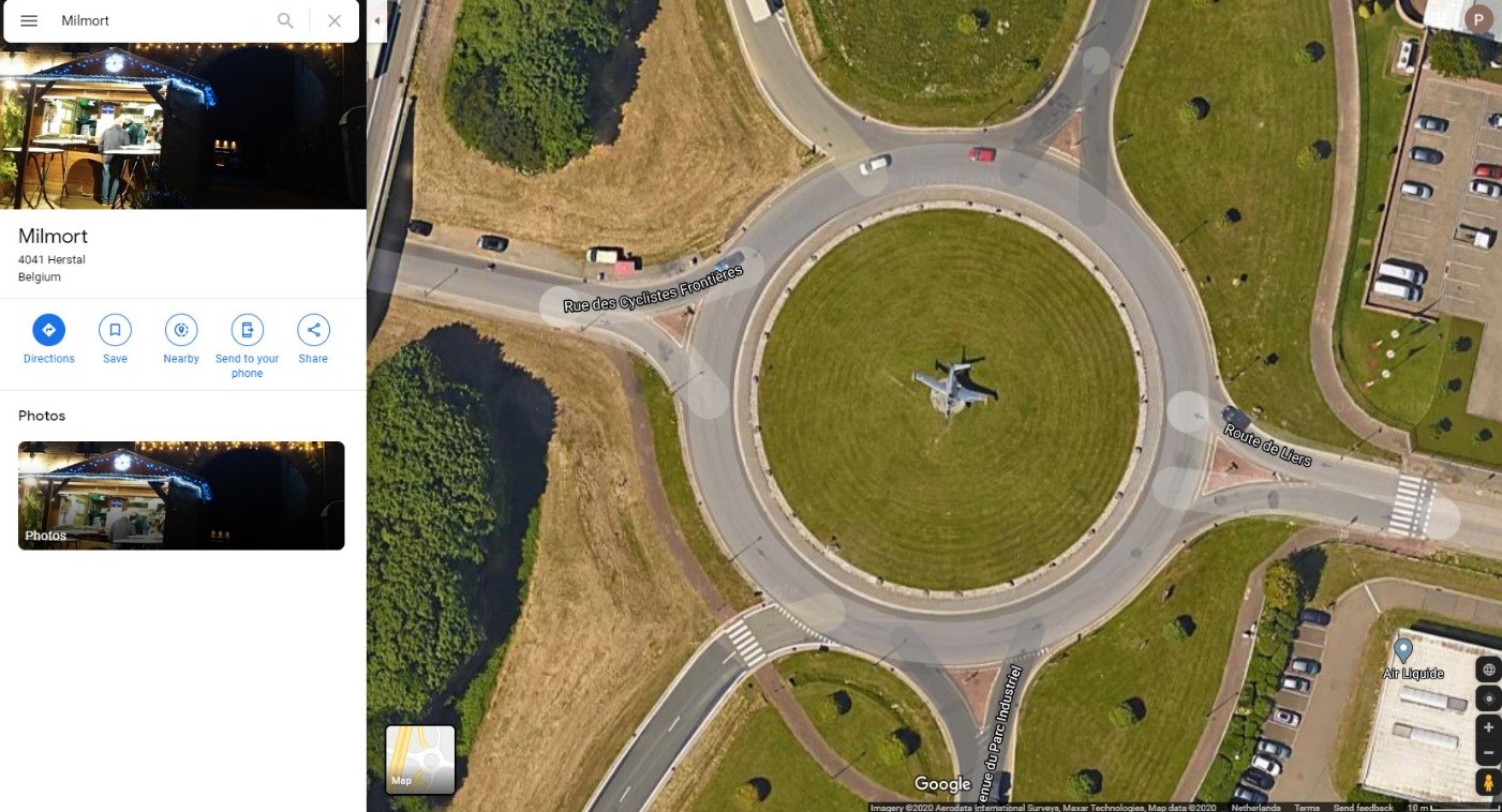
Step 5. Zoom in on the place of your aircraft.
Step 6. Click on the exact place of your aircraft and you will see a little window appear at the bottom. That window gives the exact coordinates of that spot. Copy them to your email to the AirHistory.
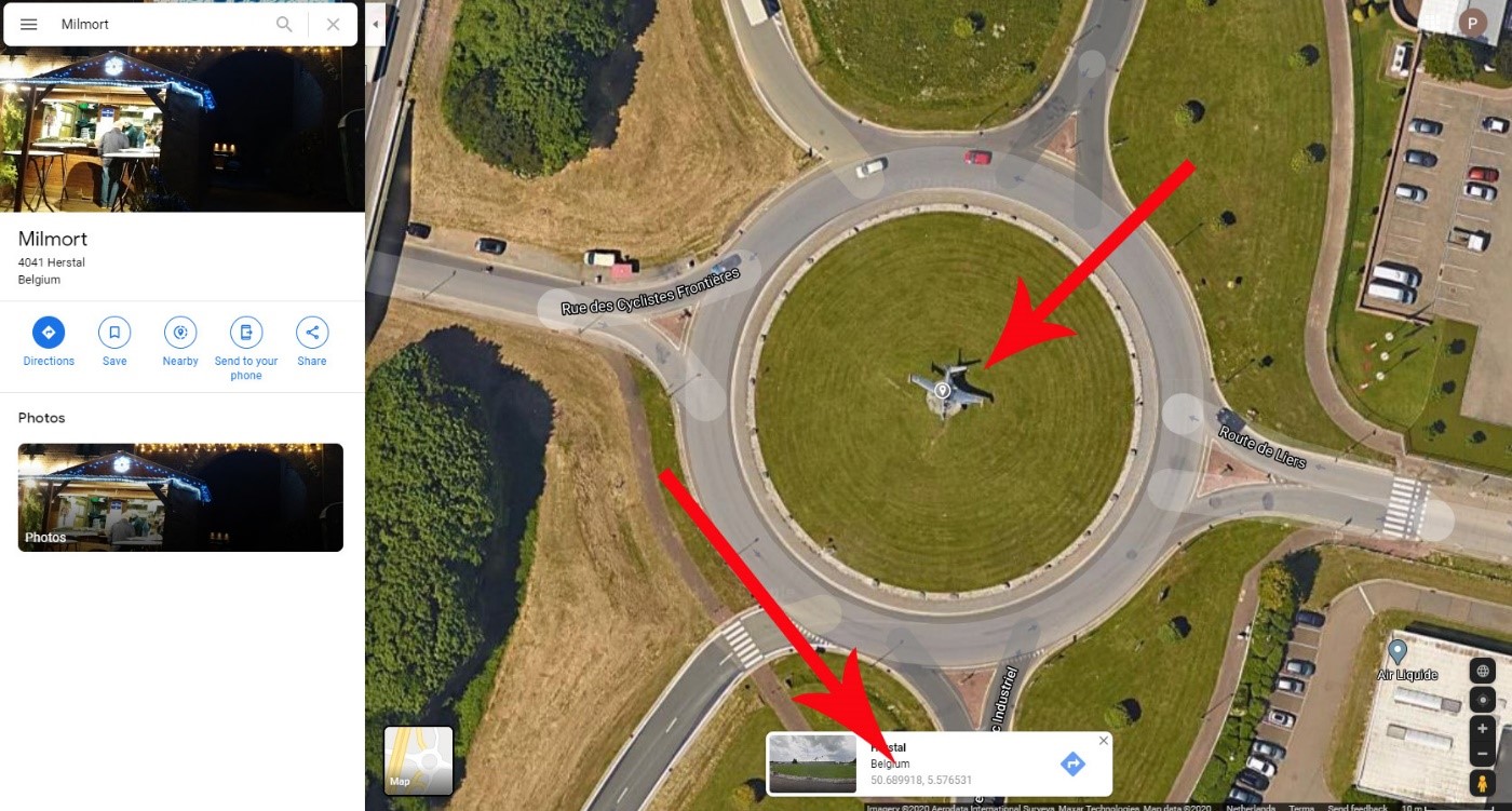
That’s all there is. Please copy-paste the coordinates instead of typing them manually, to avoid typing mistakes.
Random Picks


